
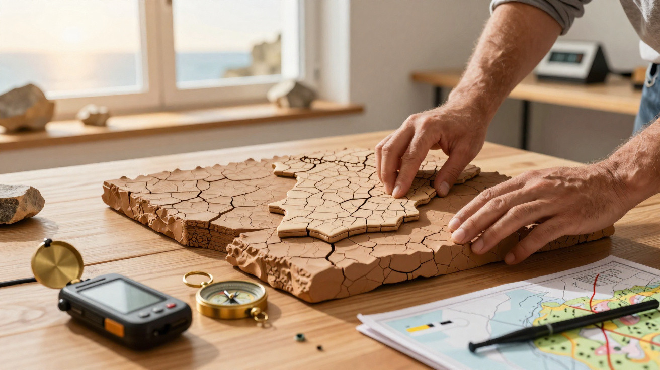
At first sight, the Iberian Peninsula appears to be a fixed, immovable part of Europe. Far beneath its surface, however, a far more unusual process is under way.
Below the vineyards, urban areas and coastlines of Spain and Portugal, tectonic forces are slowly turning the landmass clockwise. This gradual movement is changing scientists’ understanding of earthquake risk in the western Mediterranean.
A continent-sized block that will not stay still
Every continent is in motion, carried by tectonic plates that travel across the Earth’s ductile upper-mantle layer, the asthenosphere. Textbooks commonly present this process as an enormous conveyor system, with plates moving past each other, beneath one another or over one another along clear boundaries.
The Iberian Peninsula does not fit entirely within that straightforward model. In this area, the African and Eurasian plates are drawing together at only 4 to 6 millimetres a year. Although this is slower than the growth of a fingernail, over millions of years it can close oceans and build mountain ranges.
Across much of their boundary, Africa and Eurasia meet in the familiar tectonic pattern. Distinct faults, subduction zones and collision fronts show where one plate descends beneath, or collides with, another. The boundary is well defined west of Portugal in the Atlantic and along sections of the Algerian coastline.
This same plate collision that built mountains in southern Europe is also gently twisting Spain and Portugal like a giant stone steering wheel.
To the south of the peninsula, however, the situation is more complicated. Geologist Asier Madarieta and colleagues identify a broad, intricate boundary beneath southern Spain, Portugal and the western Mediterranean. Rather than being concentrated on one major fault, stress is distributed through a large area of crust and causes subtle deformation.
Uneven forces acting on the Iberian Peninsula
The Iberian block is positioned between several active tectonic areas. The African plate presses northwards from the south, while additional forces act from the side in the western Mediterranean, where the crust is compressed and rearranged.
As these forces do not align precisely, the peninsula does not merely move north alongside the Eurasian plate. Instead, it is subjected to torque - a rotational force - that gradually drives the entire block clockwise.
Instead of drifting straight north with Europe, the Iberian Peninsula is gradually pivoting around itself, turning clockwise on a geological timescale.
This is not motion that people could detect directly. It occurs at fractions of a millimetre each year and has only become apparent through dense GPS networks and detailed seismic-record analysis. Together, these data reveal slight differences in the movement of separate parts of the peninsula, which collectively produce a gentle pivot.
The Alboran domain: an essential part of the picture
A relatively small area has a disproportionately important influence on this movement: the Alboran domain, between southern Spain and northern Morocco. Confined between the African and Eurasian plates, this block is moving westwards.
Its westward movement distorts the crust around the Strait of Gibraltar and forms the curved mountain belt called the Gibraltar Arc. The arc connects Spain’s Betic Cordillera with Morocco’s Rif mountains, forming a rock-built link across the western Mediterranean.
The westward movement within the Alboran zone is uneven. Some areas undergo pronounced lateral displacement, whereas others move much less. In places where sideways movement is limited, the pressure from the African plate is transmitted more directly, compressing the crust against Eurasia.
In other locations, some of this compressive force is diverted. Instead of producing a straightforward collision, the crust may slide, flex and extend across a wide region. Consequently, deformation is distributed across hundreds of kilometres rather than concentrated along one clear fault line.
Gibraltar: where Africa “punches” Iberia
The clearest point of contact is south-west of the Strait of Gibraltar. In this location, the African plate behaves somewhat like a piston striking the side of the peninsula. This angled force both compresses Iberia and contributes to its rotation.
To the south-west of Gibraltar, Africa’s northward shove hits Iberia off-centre, generating the torque that slowly forces Spain and Portugal to rotate.
Geologists in this area find evidence of both compression and lateral movement, as well as a network of faults, some of which are buried or incompletely mapped. GPS velocity fields indicate that southern Iberia does not travel in exactly the same direction as northern Iberia, reinforcing the interpretation of an overall clockwise rotation.
Why this matters for earthquakes
Iberia is not generally considered one of the world’s highest-risk seismic regions, yet significant earthquakes do occur there. Several strike in areas with no obvious surface fault, a long-standing puzzle for specialists.
Madarieta notes that numerous parts of Spain and Portugal show deformation or seismic activity without an identifiable tectonic structure to explain it. A clearer picture of the peninsula’s rotation offers seismologists another way to interpret such events.
- The Africa–Eurasia collision produces dispersed stress across Iberia rather than only along one fault.
- Clockwise rotation indicates that concealed structures may be shearing or flexing at depth.
- Places with no mapped faults may nevertheless lie above active areas where strain is accumulating.
Knowing that the Iberian block is rotating helps specialists pinpoint zones where stress may quietly build up, even when the landscape looks stable and unbroken.
No model can predict precisely when or where the next earthquake will happen. However, recognising areas where this rotational movement concentrates stress can direct closer surveys, additional seismic stations and revised hazard maps.
What “rotation” means on a human timescale
When geologists state that Spain and Portugal are rotating, they do not mean a sudden movement that could send Lisbon into the Atlantic. The process is so gradual that millions of years are needed before it creates a noticeable positional change.
On geological timescales, however, this rotation can gradually alter mountain building, coastlines and seismic-risk patterns. Small variations in movement across the peninsula may also affect the way rivers erode the landscape and sediment is deposited offshore.
| Aspect | What happens today | Long-term effect |
|---|---|---|
| Plate convergence | Africa moves 4–6 mm/year towards Eurasia | Ongoing compression of Iberia and western Mediterranean |
| Rotation | Iberian block pivots clockwise very slowly | Shift in relative positions of regions within the peninsula |
| Seismicity | Moderate earthquakes, some on poorly known structures | Changing distribution of active faults and stress zones |
How scientists monitor a moving peninsula
Modern geodesy uses permanent GPS stations anchored in bedrock throughout Europe and North Africa. By measuring minute changes in their positions over many years, scientists can map how each part of the region moves.
Highly sensitive seismometers provide a further source of evidence. They detect earthquakes too weak to be felt by people, indicating which parts of the crust are slipping and which remain locked. When used alongside geological mapping and numerical modelling, these datasets allow researchers to reconstruct the forces affecting Iberia.
For Spain and Portugal, the evidence indicates a block under torsion, twisted between Africa and Eurasia. The Alboran domain moves westwards, while Gibraltar forms a crucial impact zone.
Key concepts behind the Iberian twist
Several specialist terms appear regularly in research of this kind. Knowing their meanings makes the processes beneath Iberia easier to understand:
- Asthenosphere: a semi-ductile layer of the upper mantle beneath the rigid plates that enables their movement.
- Subduction: the process in which one tectonic plate sinks beneath another, typically creating volcanic arcs. In western Mediterranean Iberia, much of today’s collision occurs without classic subduction.
- Diffuse plate boundary: a broad zone in which deformation is spread across numerous faults and folds instead of being focused on one line.
- Torque (twisting force): created when forces are applied off-centre; in this case, it causes the Iberian block to turn clockwise.
Models incorporating these processes allow researchers to test scenarios, including how strain could shift across southern Iberia during the next few thousand years or where stress may build along the Gibraltar Arc.
What this means for people in Spain and Portugal
For people living there, this gradual rotation will not alter everyday life. Roads will not abruptly split because the peninsula has moved a fraction of a millimetre. Its main significance is for safer construction, improved building regulations and more informed planning in areas quietly experiencing the greatest effects of this geological twisting.
Public authorities and engineers use seismic-hazard assessments that incorporate tectonic models of this type. Recognising that Iberia not only moves northwards but also rotates helps improve those assessments, particularly for coastal cities near the Gulf of Cádiz, the Algarve, Andalusia and the Strait of Gibraltar, where the tectonic forces are most complex.





Comments
No comments yet. Be the first to comment!
Leave a Comment