
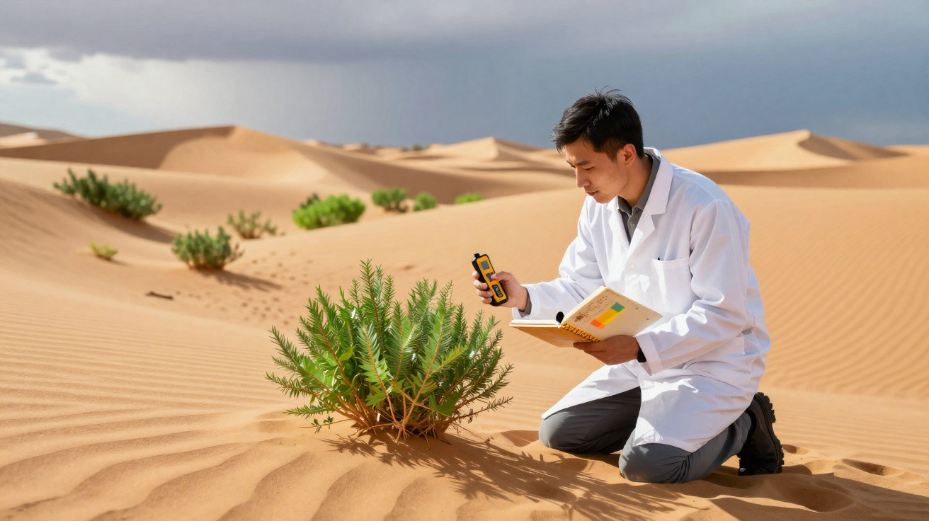
At China’s far western edge, one of the world’s driest deserts is quietly beginning to challenge long-held assumptions about arid landscapes.
For decades, the Taklamakan Desert was regarded as an empty expanse of sand and fierce winds. Now, however, its edges are becoming greener. Trees and shrubs planted on a vast scale are altering the local climate and, according to recent analyses, turning the region into an unexpected carbon sink.
A vast desert of sand beginning to turn green
Covering more than 330,000 square kilometres in western China, the Taklamakan is enclosed by mountain ranges that prevent moisture from the ocean from reaching it. This creates an extreme setting of scarce rainfall, harsh temperatures and shifting dunes that encroach on settlements and roads.
During the 1980s, the Chinese government chose to tackle desertification through a replanting initiative on a continental scale. This led to the so-called “Great Green Wall”: a belt of trees and shrubs intended to hold the soil in place, lessen sandstorms and shield towns and cropland.
Around the Taklamakan, this protective belt was established gradually. By 2024, the vegetation network surrounding the desert was considered continuous, creating a type of green ring that helps to stabilise dunes and reduce erosion from powerful winds.
The same vegetation established to hold back the sand is now emerging as an unexpected ally in tackling global warming by removing CO₂ from the atmosphere.
Satellite data and field measurements indicate that this vegetation is more than a visual change: it is modifying the carbon balance in one of the driest regions on Earth.
How the Taklamakan began capturing carbon
For a long time, deserts were treated almost as “dead zones” in the carbon cycle: few plants, little organic matter and limited involvement. The Taklamakan is overturning that view. Research examining 25 years of satellite imagery has identified a sustained expansion of green cover around the desert.
As the plants develop, their roots anchor the ground, limit the movement of sand and create a more humid microclimate at the surface. The central mechanism, though, is photosynthesis: by taking in sunlight, the plants absorb carbon dioxide and convert it into biomass.
Studies reported in scientific journals suggest that, in rainy seasons, parts of the Taklamakan’s margins can achieve a negative carbon balance. Put simply, these areas remove more CO₂ from the air than they release, operating as a seasonal carbon “sink”.
Regional measurements show seasonal falls in atmospheric CO₂ from around 416 to 413 parts per million, linked to peak plant activity.
The difference may seem slight, but at a regional level it represents a real shift: a desert traditionally seen as a net source of dust and heat is beginning to act as a regulator of the local climate.
Why the rainy season matters
Water is the key to this change. From July to September, rainfall rises to roughly 16 millimetres per month. For an arid region, even that increase is significant.
At this time, plants make use of every drop. Vegetation becomes denser, satellite images show a pronounced spread of green, and the rate of photosynthesis increases. This is when the Taklamakan most clearly becomes a carbon-capturing landscape.
- Rainfall from July to September: around 16 mm/month;
- Visible growth in vegetation along the desert margins;
- Greater CO₂ absorption during the wet season;
- Seasonal reduction of atmospheric CO₂ in the region;
- Stabilisation of areas previously regarded as unstable.
The pattern returns year after year: the desert effectively “breathes” carbon according to the rains, as though it has acquired a new biological rhythm.
The Taklamakan as an open-air climate laboratory
What is taking place there matters far beyond China’s borders. The Taklamakan has become a living laboratory for testing how far replanting can alter the way arid environments function.
The project demonstrates that carefully planned interventions can generate rapid results, even where water is scarce. A combination of drought-tolerant species, irrigation management and continuous monitoring has made it possible to establish a belt of vegetation where there was once only unstable sand.
The experience suggests that dry areas need not be viewed solely as victims of the climate and can instead become an active part of the solution.
This gives researchers more realistic data for climate models on the interactions between sandy soils, sparse vegetation and dry air. In turn, it helps refine projections of temperature, moisture flows and greenhouse-gas concentrations in arid regions across the planet.
Limits, risks and unanswered questions
The progress is not assured indefinitely, however. Maintaining this new dynamic depends on several sensitive factors:
| Factor | Risk | Possible consequence |
|---|---|---|
| Rainfall | Reduced precipitation | Water stress and plant death |
| Temperature | More frequent heatwaves | Drier soil and less photosynthesis |
| Management | Cuts to management investment | Loss of reforested areas |
| Species | Use of poorly adapted plants | Low long-term survival |
Global warming may make rainfall less predictable, extend dry spells and place new pressures on plants. Without ongoing monitoring, some of the gains achieved since the 1980s could be lost.
What this case reveals about deserts and climate
The Taklamakan example prompts a reassessment of several entrenched ideas. First, a desert is not synonymous with an absence of life or with complete climatic irrelevance. With suitable management, desert margins can develop vegetation and contribute to carbon sequestration.
A further lesson concerns the idea of a “carbon sink”. In climate terminology, this means any system that absorbs more CO₂ than it emits, including forests, oceans and soils. What is surprising here is seeing an arid environment move towards that role, even if only locally and seasonally.
For other countries dealing with desertification - from the African Sahel to Brazil’s semi-arid region - the Taklamakan serves as proof of concept. There is no single solution, but combining targeted reforestation, the selection of resilient species and water management can provide two benefits: slowing soil loss and capturing carbon.
Practical applications and future scenarios
If China’s approach were to inspire comparable projects along other desert margins, it could create a global network of green belts. Each would have a modest effect individually, but together they could produce a meaningful cumulative impact on the carbon balance.
At the same time, these belts deliver highly tangible local advantages: less airborne dust, reduced wear on infrastructure, protection for agricultural land and even new economic opportunities associated with forest management, seed collection and research.
For readers interested in climate, the Taklamakan helps to clarify several terms. “Carbon sequestration” is not simply a distant technical expression: it is the process through which trees, shrubs, grasses and even soils store for years or decades the CO₂ that is currently warming the atmosphere. “Microclimate”, meanwhile, describes the subtle changes in temperature, humidity and wind that arise when a place gains shade, roots and moisture in its soil.
Simulations produced by researchers outline scenarios in which the region could gradually strengthen its role as a seasonal sink if the green belt remains healthy. In the opposite scenario - rainfall collapse or the abandonment of management - the area would once again release more carbon than it retains, while also intensifying dust storms that affect cities hundreds of kilometres away.
Between these two extremes, the Taklamakan remains, for now, both a warning and an opportunity: a reminder that even a sea of sand can change its role when it is given, persistently, roots, leaves and a little more water.




Comments
No comments yet. Be the first to comment!
Leave a Comment